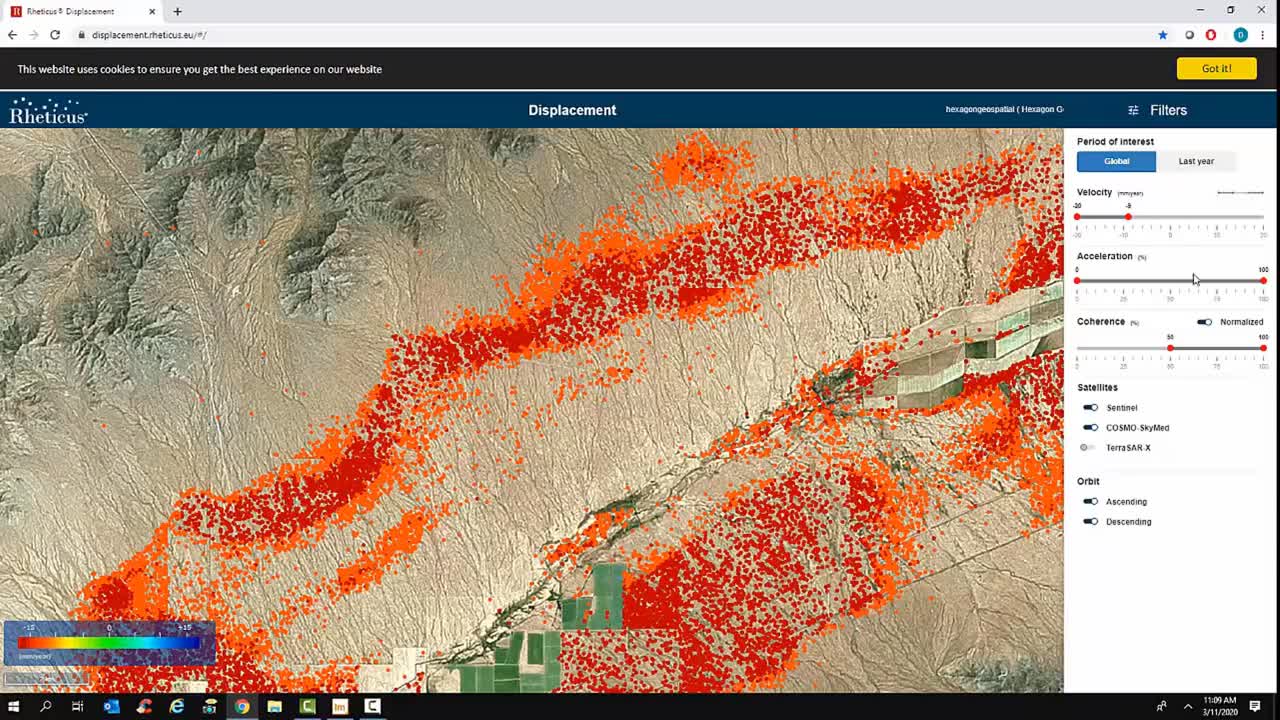
Subsidence of the Earth’s surface can have catastrophic consequences to structures, business operations, local inhabitants, and the environment. Subsidence mapping is a very sophisticated technology that has made the transition from research to real-world applications. In this Tech Talk, learn how you can order and then exploit displacement data based on interferometric SAR time-series analysis using ERDAS IMAGINE. In this example, a water aquifer in Arizona has experienced some land subsidence. Combining detailed Subsidence Maps as a Service reports, Rheticus Displacement, and InSAR tools, the extent of the subsidence can be examined for mitigation planning.