M.App X brings GeoIntelligence workflows to the cloud.
In this demo, an Image analyst has been asked for verification of a military hardware reduction treaty, which includes site monitoring of a location of de-commissioned cargo aircraft to make sure they remain de-commissioned.
1. Display multiple dates of imagery and compare to confirm ongoing adherence to the treaty.
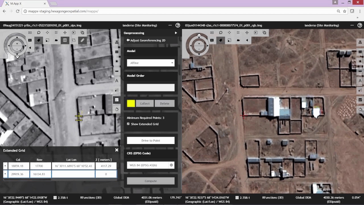
2. Receive the latest satellite surveillance imagery and attempt to overlay, but discover that the positional accuracy is not good enough
3. Adjust the new image to positionally match the existing data
4. Overlay adjusted image, compare using blend and identify potential treaty violation
5. Create report to task a field operative to verify on the ground and confirm adherence (the aircraft was being dismantled for scrap, not brought back into service)